Langley Sustainable Urban Extension

Public Engagement Event November 2022

WELCOME

Thank you for visiting the online engagement page for the Langley Sustainable Urban Extension (SUE).

The Story So Far…

Langley was allocated in the Birmingham Development Plan (BDP) in 2017 by Birmingham City Council for a mixed use sustainable urban extension (Policy GA5). BCC subsequently adopted the Langley Supplementary Planning Document (SPD) in 2019 to guide future development proposals.

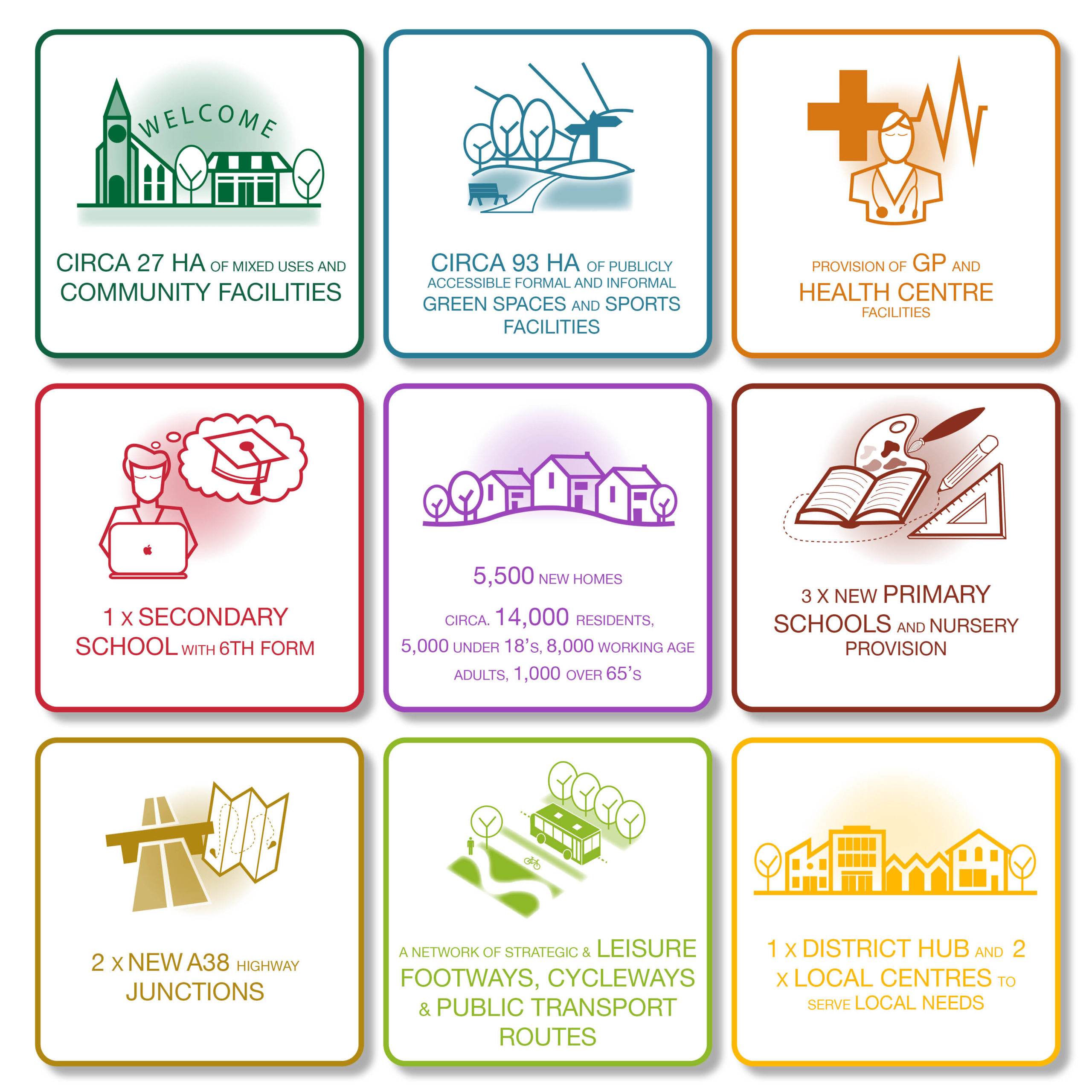
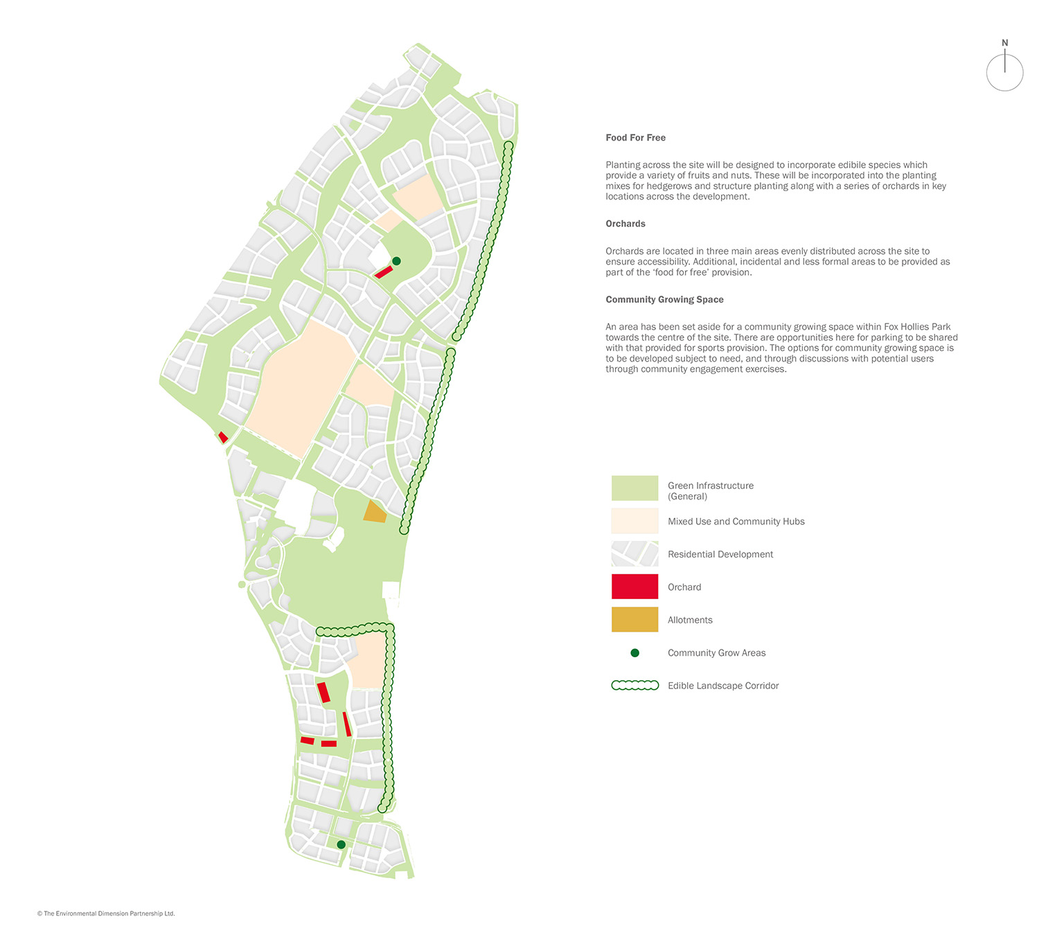
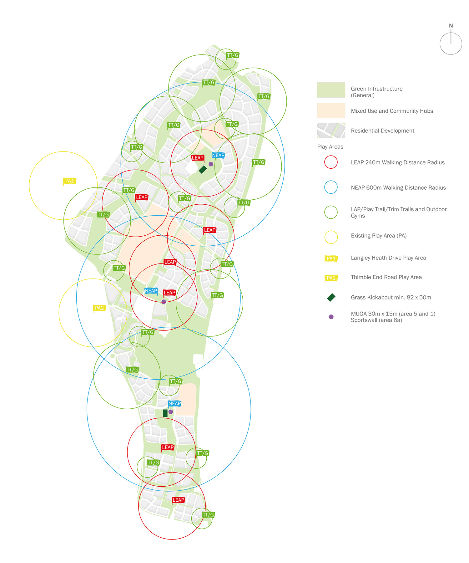
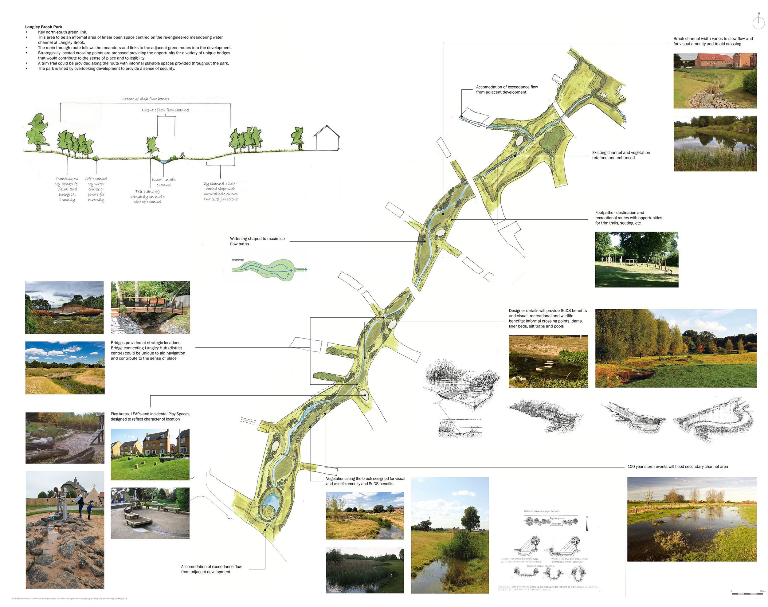
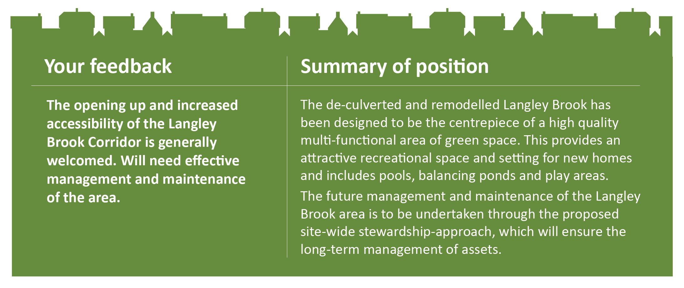
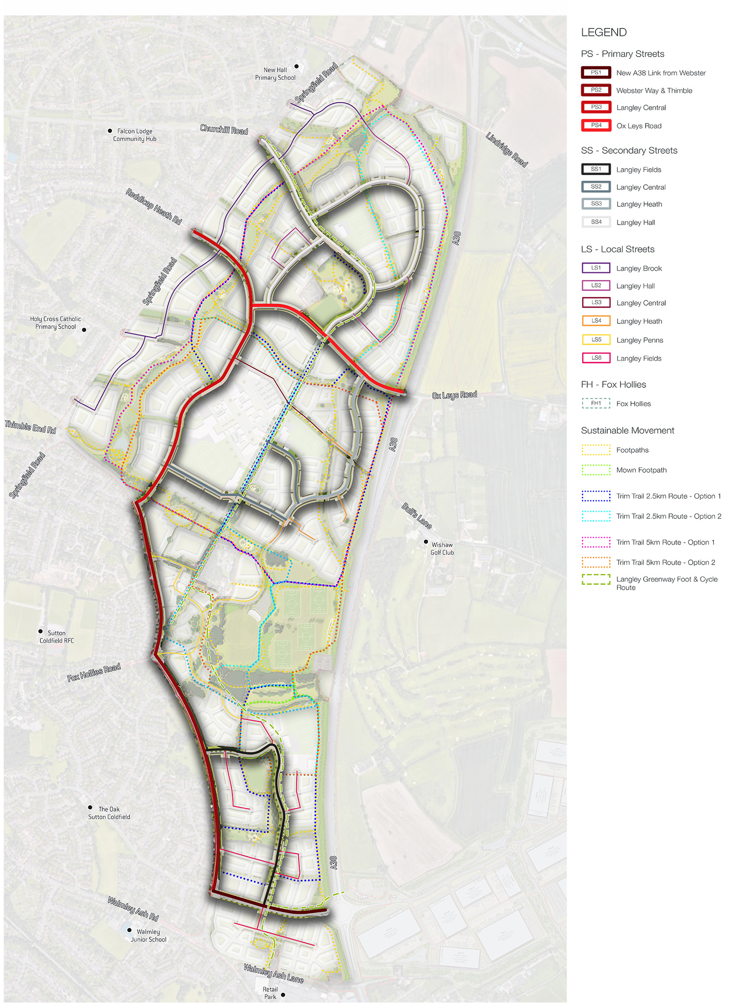
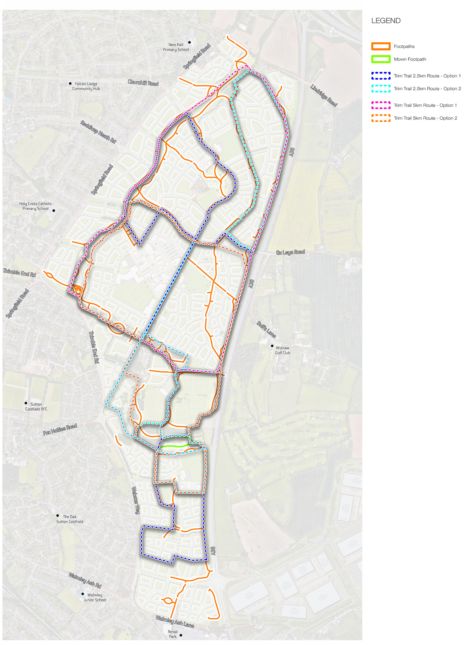
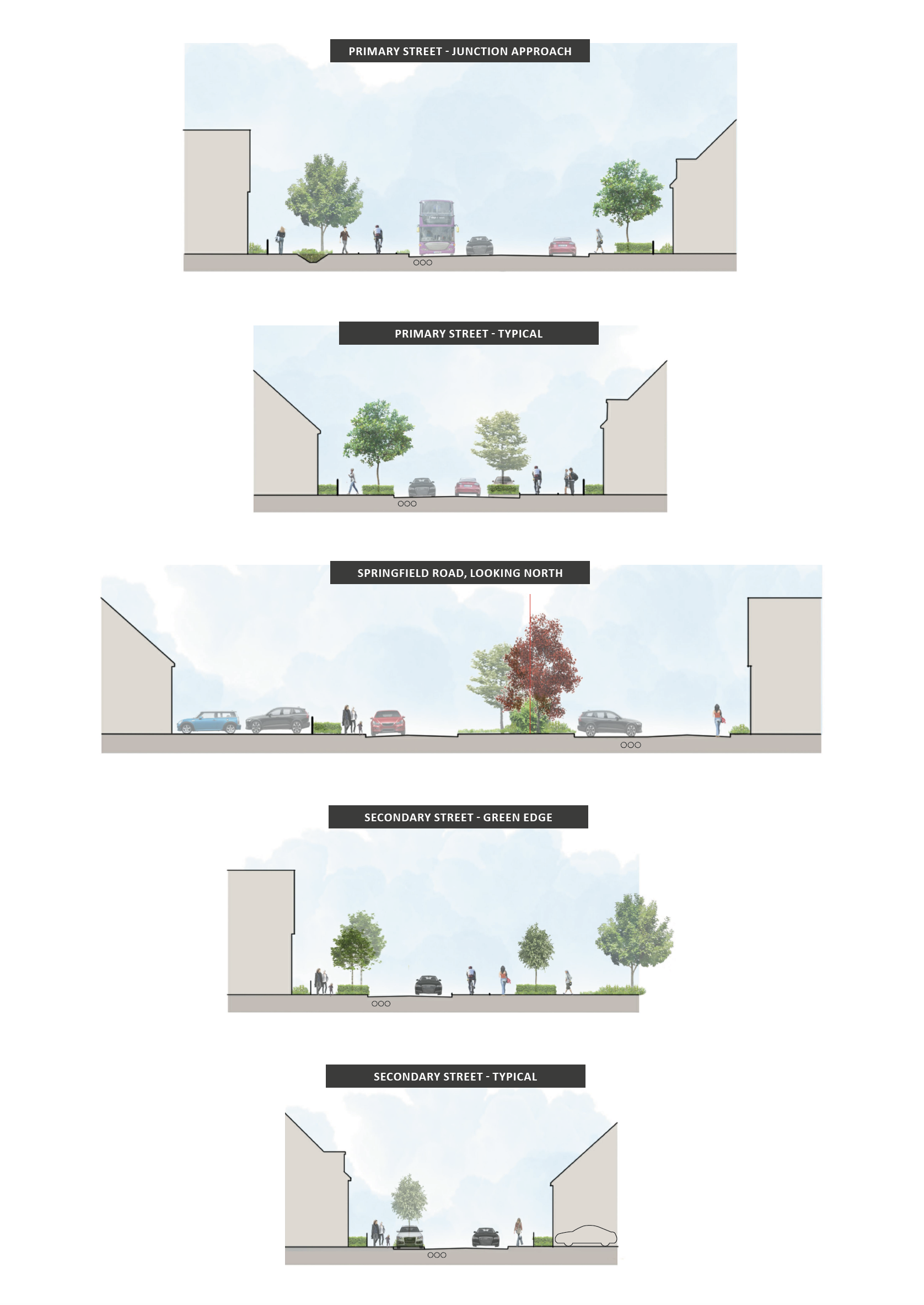
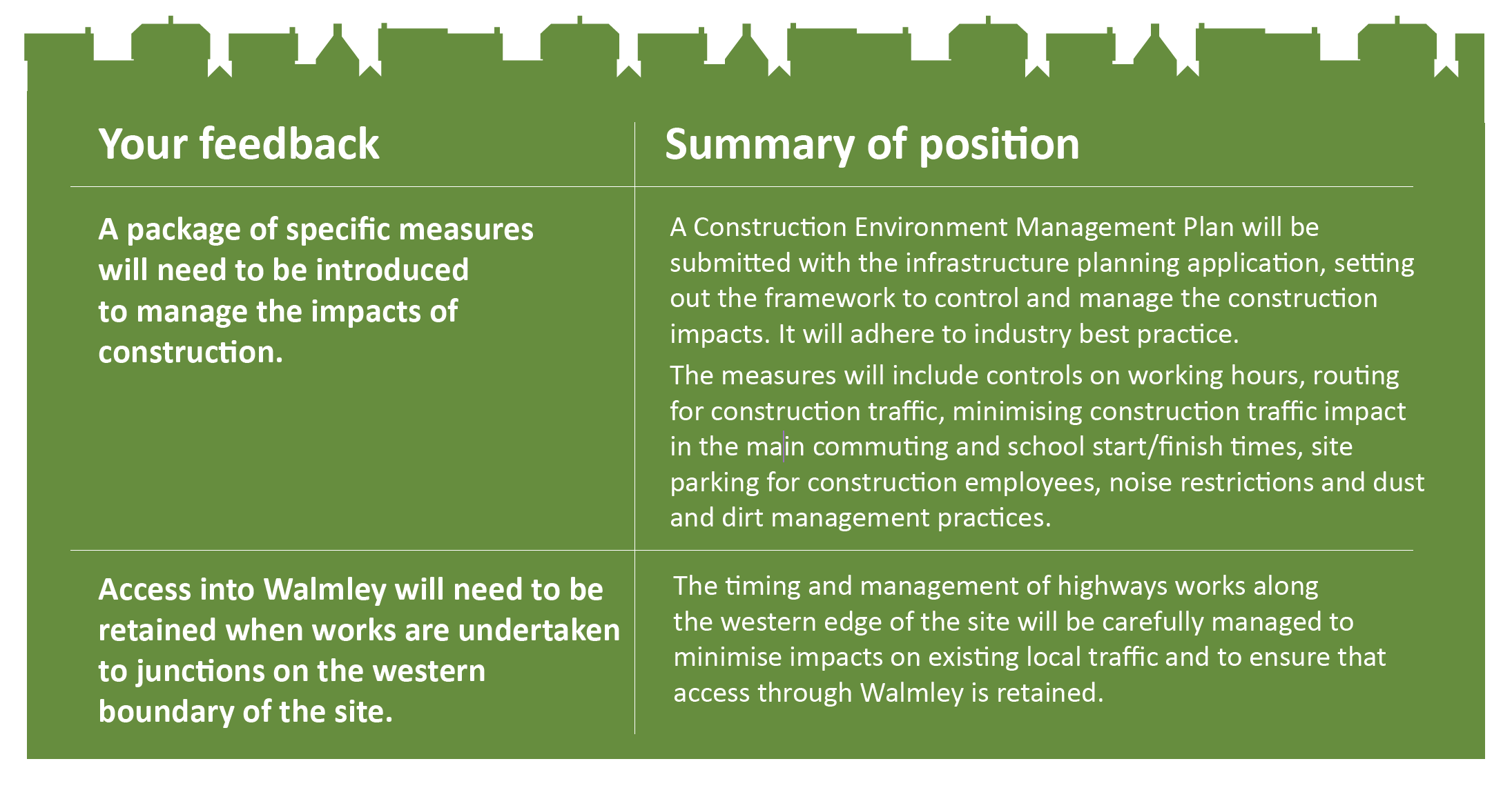
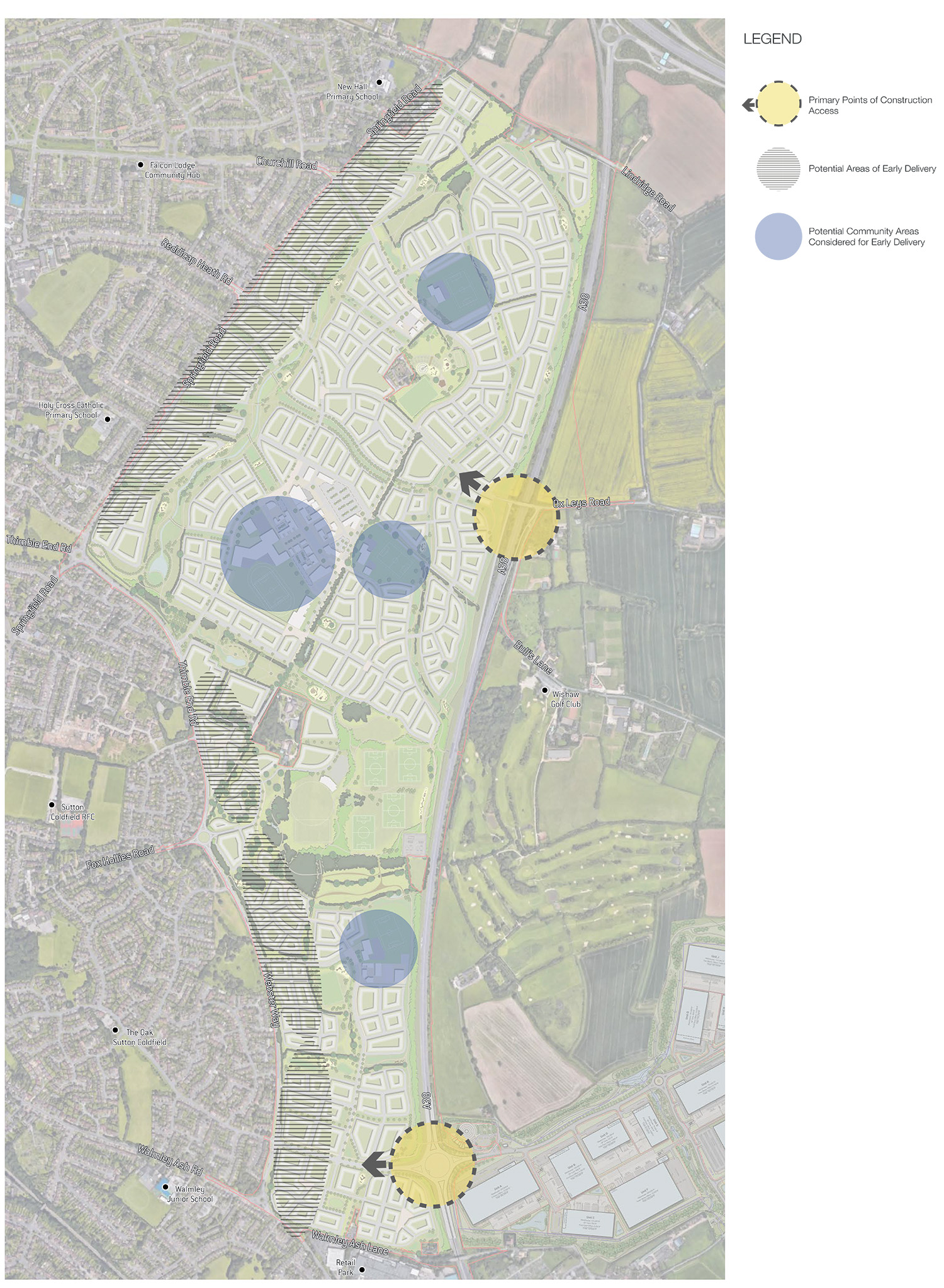
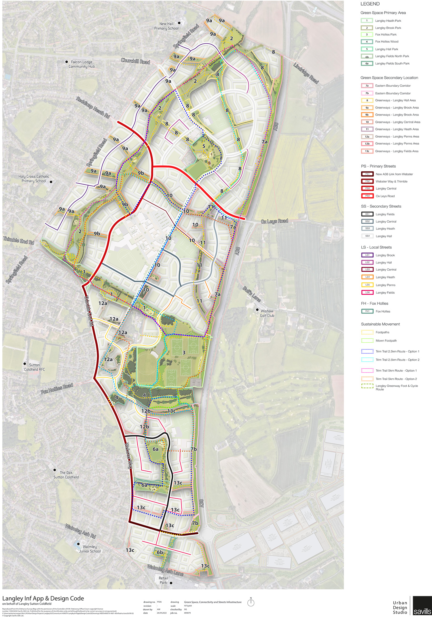
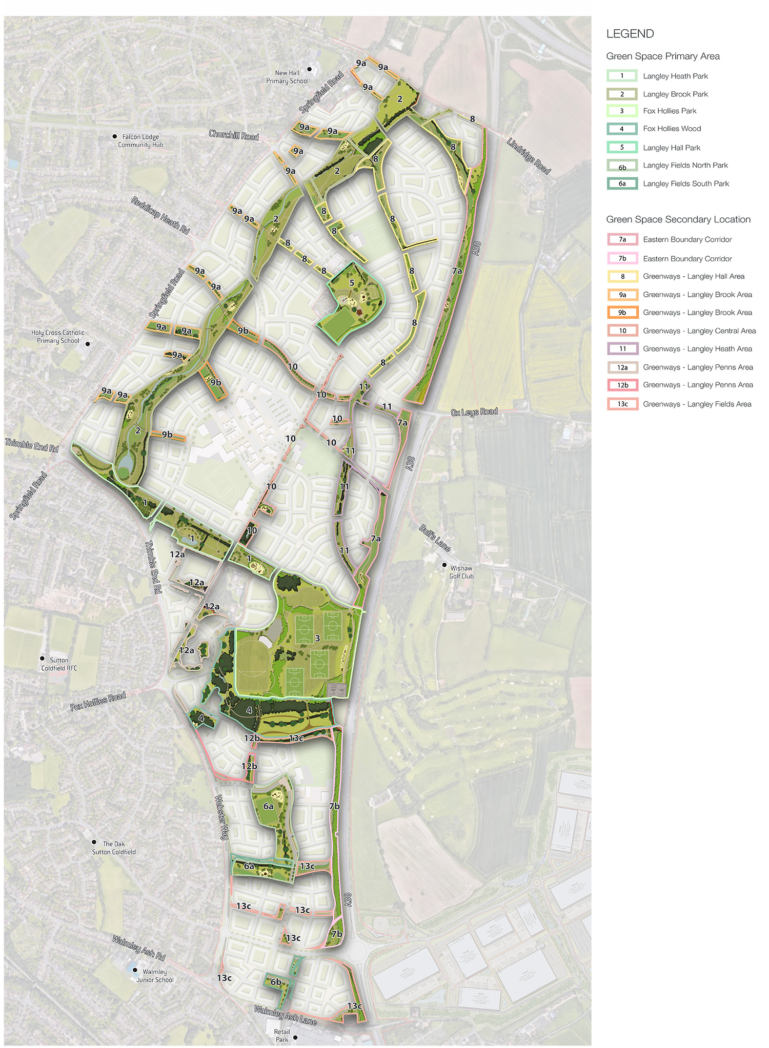
The Consortium Members (Homes England, Taylor Wimpey, Vistry Homes, New Hall Estates and William Davis) submitted an outline planning application [ref 2021/10567/PA] to Birmingham City Council in 2021, for up to 5,500 new homes and associated infrastructure including new schools, health centre, community facilities, retail, leisure, open space, play areas and sustainable drainage on the site.

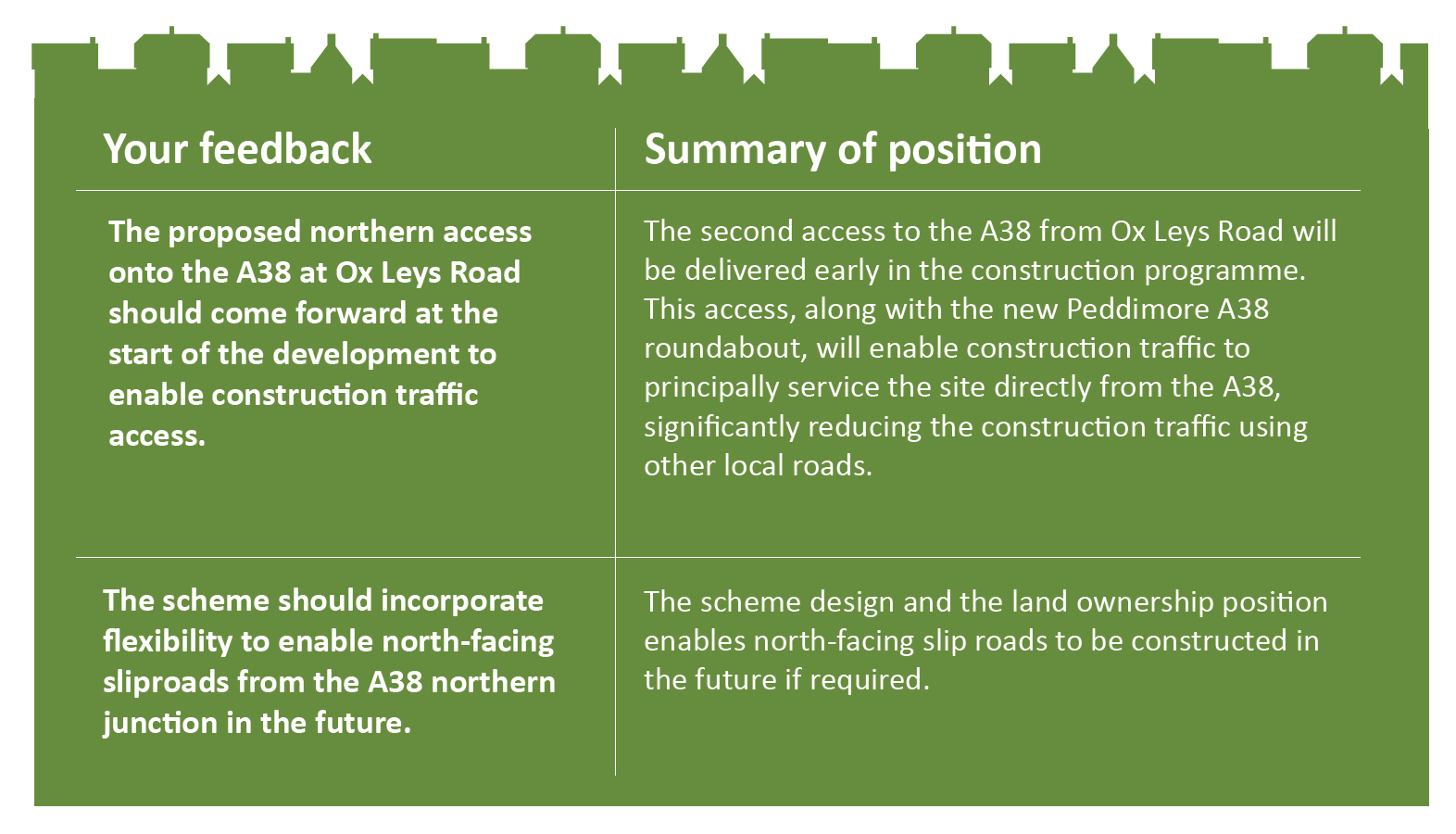
Details for the principal points of access into the site, including two new accesses to the A38, were also submitted.

Langley is


The Purpose of this Engagement


The Consortium has been progressing the design work for the strategic infrastructure application for the scheme which will cover open space / landscaping (green infrastructure), surface water drainage and connectivity within the site. The key elements of the proposed strategic infrastructure and their broad locations are included on the plan below. 

The Consortium is focusing on getting the strategic infrastructure approach right before it starts work on the design of buildings. 

Following the public engagement sessions in July 2022, the Consortium has carefully reviewed and assessed all the comments received. The feedback has informed the production of more detailed plans to support the proposed planning application. 

This event is intended to provide further details on the proposals prior to the submission of the strategic infrastructure application.

Infrastructure Plan


Green Infrastructure


Our Objective:
How can the green infrastructure be provided to meet the needs of the whole community?

Green Infrastructure is a term used to refer to the network of green spaces, water and other environmental features.

The Langley Green Infrastructure network will deliver a range of community and environmental benefits and provide a high-quality and attractive setting for the new neighbourhoods. 

Over a third of the site will comprise Green Infrastructure. This will include watercourses, trees, hedgerows, woodlands and ecological features, new parks, a Sports Hub, sustainable drainage features, Langley Brook Corridor, opportunities for wildlife, boundary landscaping, pedestrian and cycle routes, connecting greenways, informal community meeting spaces, a range of play areas and community growing spaces.


EDIBLE LANDSCAPE FEATURES


GREEN INFRASTRUCTURE PLAN


PLAY AREAS PLAN

PUBLIC ART PLAN

Surface Water Drainage


Our Objective:
Design the scheme to optimise community and environmental benefits from the surface water drainage strategy.

Sustainable Drainage Systems

The proposals will incorporate sustainable drainage systems known as SuDS. 

The surface water drainage systems have been designed with consideration of both the existing surroundings and the proposed development. Existing features of the Langley Brook are being maintained, enhanced and adapted for increased environmental and community benefit. 

The SuDS incorporated throughout the site aim to mimic the existing drainage conditions, whilst providing benefit by slowing down the progress of water into existing watercourses and reducing the impact of extreme rainfall events both locally and downstream. SuDS also deliver benefits for wildlife and improve the general amenity of a development. 

SUSTAINABLE DRAINAGE SYSTEMS

Langley Brook Corridor


Langley Brook is located within the north-western area of the site and runs parallel to Springfield Road. A new linear park will be created, with the brook as its central feature. 

Langley Brook Diagram


Existing Brook

Connectivity & Movement


Our Objective:
Design the scheme to encourage residents to reduce reliance on (combustion engine powered) private vehicles.

A network of new and existing roads, together with walking and cycling routes will be provided. The Consortium wants to encourage active travel and is proposing:

  • Walking and cycling routes, separated from traffic, along most streets;
  • Early delivery of a walking and cycling route on the western edge of the site;
  • A north-south walking and cycling route through the centre of the site;
  • New walking and cycling routes through the open spaces within the site;
  • Public rights of way;
  • Electric vehicle charging points throughout the site, and
  • Potential for a mobility hub and car sharing clubs.


CONNECTIVITY PLAN

The planned network of footpaths, including trim trail routes, is shown in the plan below:

SUSTAINABLE MOVEMENT PLAN

FOOTPATH SECTIONS

The main primary and secondary streets will be located within the strategic infrastructure land. These will be the focus for bus routes within the site. Fox Hollies Road will be widened and will facilitate the passage of Sprint Bus (Bus Rapid Transit) through the site, including a bus gate to stop Fox Hollies Road becoming a through-route. 

STREET VIEWS

ACCESS TO THE A38

The new southern roundabout has recently been constructed as part of the proposals for the new ‘Peddimore’ employment development. The new northern access from Ox Leys Road will also enable traffic from the east of the site to access the A38 sooner

CAR PARKING AND ELECTRICAL VEHICLE PARKING

Stewardship


The intention is that the green infrastructure, surface water attenuation features and some of the community buildings will be managed and maintained through a management vehicle, funded through an annual contribution from the new residents. The Consortium is exploring the most appropriate way to achieve this which ensures effective management and enduring stewardship with genuine community involvement. 

It is expected that the majority of the roads within the site will be adopted by Birmingham City Council 

Delivery and Next Steps


Development, subject to planning approval, will initially start along the western boundary of the site and move eastwards, as well as opening up construction in other areas of the site when the necessary infrastructure is in place. Construction activity is expected to commence in 2023. There is expected to be a 15-20 year construction period. 

The strategic infrastructure application will be submitted within the next few months. 

After this, the Consortium will start designing the appearance and layout for the residential development and mixed-use areas, including the schools, health centre and other community uses. Reserved matters applications will be produced for these areas following the approval of the outline planning application. 

Design Codes will be produced to guide the design process and ensure that the designs for each character area within the site achieve the required design standards and quality. 

Further public engagement will be undertaken to inform the detailed designs for the built areas of the site. 

CONSTRUCTION AND DELIVERY PLAN